
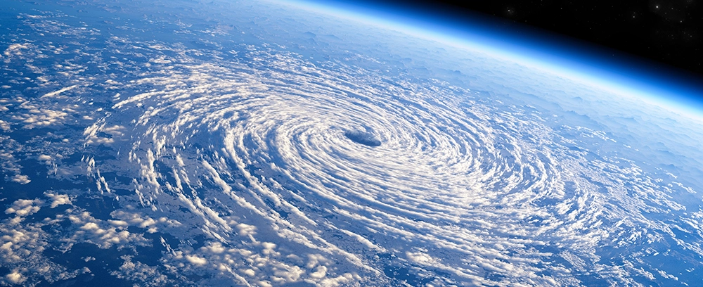
Why is Meteorology Important?
Accurate meteorological insights are essential for:
- Public safety – Preparing for storms, floods, or heatwaves.
- Transportation – Ensuring flight and maritime safety.
- Agriculture – Helping farmers plan irrigation and harvests.
- Energy – Predicting wind and solar availability for grid management.
At Buluttan, we go beyond traditional forecasting by integrating AI with meteorological data to offer hyper-local, highly accurate predictions tailored to specific industries.
Key Concepts in Meteorology
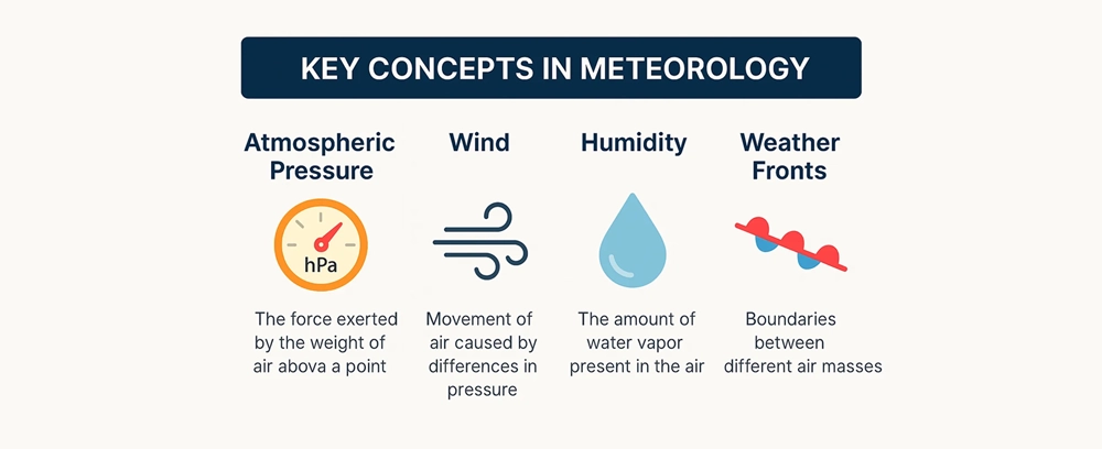
Meteorology is built on a foundation of physical principles that govern atmospheric behavior. To understand weather forecasts and climate models, it’s important to grasp a few core elements:
Atmospheric Pressure
Atmospheric pressure is the force exerted by the weight of air above a given point. It influences wind, precipitation, and storm development. Falling pressure often signals bad weather, while rising pressure indicates clearing skies.
Wind and Air Movement
Winds are caused by differences in atmospheric pressure. High-pressure systems push air toward low-pressure areas, creating wind. The direction and speed of wind affect weather conditions and the movement of storm systems.
Humidity and Precipitation
Humidity refers to the amount of water vapor in the air. When humid air cools, it condenses into clouds and may produce rain, snow, or storms. Understanding dew points and relative humidity is crucial for forecasting.
Temperature and Heat Transfer
Temperature differences between regions cause air to move and weather to form. Meteorologists track how heat transfers between the land, sea, and atmosphere to predict changes in the weather.
Weather Fronts and Systems
Cold fronts, warm fronts, and pressure systems are the building blocks of weather changes. These systems determine whether we’ll see sunshine, rain, or storms over a specific region.
Meteorological Instruments
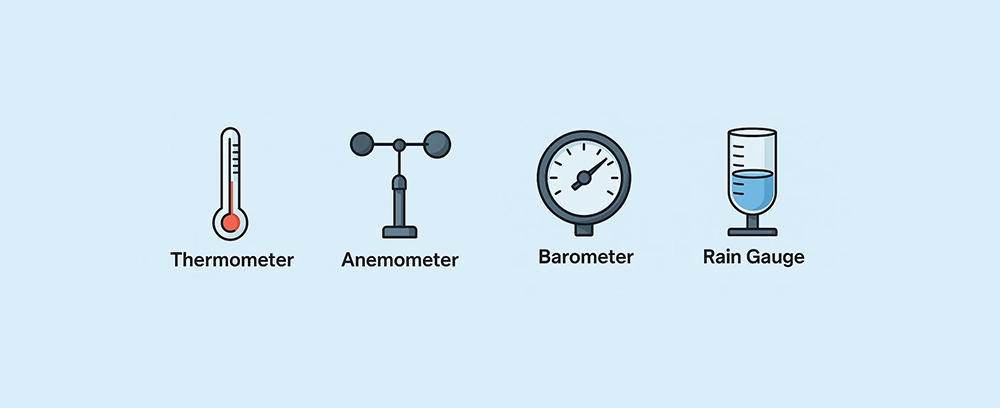
Accurate weather forecasting depends on the precise measurement of atmospheric conditions. Meteorologists use a variety of tools to observe and monitor the environment in real time.
Barometer
A barometer measures atmospheric pressure. Changes in barometric pressure help predict short-term weather changes, such as the arrival of a storm system or clearing skies.
Anemometer
An anemometer measures wind speed and direction. It’s essential for aviation, maritime navigation, and understanding the movement of weather systems.
Hygrometer
A hygrometer gauges the moisture content in the air, or humidity. It’s used to assess the likelihood of precipitation, fog, and dew.
Thermometer
Thermometers measure temperature at specific locations. This data is used in weather models and forecasts, and to track climate patterns over time.
Weather Balloon
Weather balloons carry instruments into the upper atmosphere to collect data on temperature, pressure, and humidity at various altitudes. This vertical profile is critical for accurate forecasting.
Rain Gauge
Rain gauges collect and measure precipitation. They help track rainfall patterns, flood risks, and water availability for agriculture.
Each of these instruments plays a critical role in the real-time monitoring and prediction of weather conditions.
Modern Meteorology and Technology
Meteorology has evolved from manual observations to data-driven forecasting powered by advanced technology. Today, modern meteorology relies on a combination of satellites, sensors, supercomputers, and artificial intelligence to deliver highly accurate and timely forecasts.
Satellite Observations
Satellites provide continuous, global coverage of atmospheric conditions. They capture images of cloud formations, track storms, measure sea surface temperatures, and monitor environmental changes such as wildfires or pollution.
Numerical Weather Prediction (NWP)
NWP uses mathematical models of the atmosphere to simulate future weather patterns. These models process vast amounts of data collected from ground stations, balloons, and satellites, helping meteorologists forecast with greater confidence over short and long-term periods.
Artificial Intelligence in Forecasting
AI and machine learning are transforming weather prediction by identifying complex patterns in atmospheric data that traditional models may miss. AI enhances:
- Localized forecasting accuracy
- Prediction of extreme weather events
- Real-time updates and alerts
At Buluttan, we combine deep learning with traditional models to improve forecast precision across all timeframes and geographies. Our platform is especially effective in dynamic environments like ports, cities, and renewable energy sites.
Real-Time Data Systems
Modern forecasting also depends on real-time data inputs. Weather sensors, IoT devices, and radar systems continuously feed data into models to provide up-to-the-minute insights for decision-making.
Applications of Meteorology
Meteorology is essential to a wide range of industries and public services. Accurate weather data supports planning, safety, and efficiency across many sectors.
Aviation and Transportation
Airlines, airports, and maritime operations rely heavily on weather forecasts. Wind speeds, visibility, and storm tracking are critical for routing, scheduling, and ensuring passenger safety.
Agriculture
Farmers use meteorological insights to make decisions about planting, irrigation, fertilization, and harvesting. Accurate forecasts help protect crops from frost, drought, and severe weather.
Renewable Energy
Wind and solar energy production depend on atmospheric conditions. Forecasts help energy providers plan capacity and stabilize the power grid based on expected generation.
Emergency Management
Governments and disaster response agencies depend on forecasts to prepare for and respond to extreme weather events such as hurricanes, floods, and wildfires. Timely alerts save lives and reduce property damage.
Urban Planning
Meteorology supports smart city development by informing infrastructure decisions related to drainage, pollution control, and climate resilience.
Logistics and Supply Chains
Weather can disrupt shipping routes, road conditions, and delivery timelines. Forecasting enables companies to anticipate delays and reroute shipments efficiently.
Why Accurate Forecasting Matters
Accurate weather forecasting is more than a convenience—it’s a critical component of safety, economic stability, and environmental resilience. As weather patterns grow increasingly unpredictable due to climate change, precision in meteorological predictions has never been more vital.
Protecting Lives and Property
Timely forecasts enable communities to prepare for severe weather events such as storms, floods, and heatwaves. Early warnings help people evacuate or take shelter, reducing casualties and damage.
Supporting Business Operations
Industries like energy, agriculture, and transportation depend on accurate forecasts to make informed decisions. For example:
- Power grids rely on wind and solar availability forecasts
- Airlines adjust flight paths based on storm activity
- Farmers time crop cycles around weather conditions
Enabling Government and Emergency Planning
Local and national governments use meteorological data for infrastructure planning, disaster response, and public safety initiatives. Forecasts also inform decisions on school closures, road treatments, and water resource management.
Saving Costs
Inaccurate weather predictions can lead to operational inefficiencies, product loss, and wasted resources. Reliable forecasts help organizations minimize risks and optimize performance.
Building Climate Resilience
Long-term forecasting and historical weather data help researchers and policymakers understand climate trends, prepare for future risks, and design more resilient systems.
How Buluttan Enhances Forecasting
At Buluttan, we combine the power of artificial intelligence with traditional meteorological science to deliver accurate, hyper-local forecasts tailored to the needs of modern industries.
AI-Powered Forecast Models
Our forecasting engine integrates deep learning techniques with Numerical Weather Prediction (NWP) to analyze vast datasets from satellites, weather stations, and IoT devices. This hybrid approach improves forecast precision across various timescales—from minutes to weeks ahead.
Hyper-Local Weather Intelligence
Most weather services deliver regional predictions. Buluttan goes further by offering street-level forecasting. This level of detail helps businesses make real-time decisions based on exact site conditions—whether it’s a shipping terminal, solar field, or urban neighborhood.
Industry-Specific Solutions
We provide customized meteorological tools and dashboards for:
- Ports and Maritime Logistics: Prevent weather-related delays and optimize operations.
- Renewable Energy Providers: Predict power generation and mitigate output variability.
- Aviation and Transportation: Ensure safety and efficiency with reliable data.
- Agriculture and Water Management: Improve yield planning and resource use.
Scalable Technology
Our cloud-based infrastructure supports seamless integration with business systems via API, enabling automated decision-making based on weather intelligence.
Continuous Improvement
By constantly learning from new data and user feedback, our models adapt and improve over time—delivering more relevant and timely insights with every forecast cycle.
FAQs About Meteorology
What tools do meteorologists use?
Meteorologists use instruments such as barometers (for air pressure), thermometers (for temperature), anemometers (for wind speed), hygrometers (for humidity), and weather balloons (for upper-atmosphere data). They also rely on satellites, radar systems, and computer models for large-scale monitoring and forecasting.
What is barometric pressure?
Barometric pressure is the pressure exerted by the atmosphere at a given point. It helps predict short-term weather changes—falling pressure often indicates stormy weather, while rising pressure suggests clearing skies.
How accurate are modern forecasts?
Modern forecasts are highly accurate for short- and medium-range timeframes, thanks to advanced satellite data, real-time sensors, and AI-enhanced models. Accuracy tends to decrease the farther out a forecast extends, but continuous model improvements are closing this gap.
How does AI improve weather forecasting?
AI enhances forecasting by processing large amounts of meteorological data faster and identifying patterns that traditional models might miss. It improves accuracy, enables hyper-local predictions, and helps deliver faster updates during rapidly changing weather conditions.
See What Accurate Forecasting Can Do for You
Whether you’re managing a port, optimizing a solar plant, or planning city infrastructure, precise weather intelligence can transform your operations. Buluttan delivers the accuracy, speed, and localization you need to make smarter, weather-aware decisions.
Ready to Experience the Future of Meteorology?
Partner with Buluttan and gain access to:
- AI-powered, hyper-local weather forecasts
- Custom dashboards for your industry
- Seamless integration via API
- Scalable solutions for any size operation
Contact us today to learn how we can help your business stay ahead of the weather—or request a demo to see our technology in action.